Amazing Data/Map Mashup – Old NYC
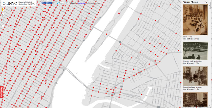
Old NYC: Mapping images from the NY Public Library is an amazing site. Historical photos from the New York Public Library are geolocated to a map of NYC. Interested to see Times Square throughout time? Times Square!
For someone who loves data, history, architecture and maps as much as I do this site is like digital design heroin for me! It is so well done I highly recommend that you check it out.
A good write up about the images and project can be found on their about page, here’s a snippet:
This site provides an alternative way of browsing the NYPL‘s incredible Photographic Views of New York City, 1870s-1970s collection. Its goal is to help you discover the history behind the places you see every day.








New post: Amazing Data/Map Mashup http://t.co/g8kMhAbWc7